

Land Surveyors Explained: Defining Property Boundaries and Sites

Introduction
A land surveyor is a licensed professional dedicated to accurately measuring and documenting the physical features of the Earth’s surface. Essentially, they define where property lines are and how structures are situated on a parcel of land. While their role involves precise mathematical calculations, their primary function is legal and technical: to establish geographical data that is often legally binding. If you have a property, are planning construction, or are resolving a boundary dispute, a land surveyor is a critical resource. They do more than just draw maps; they connect physical evidence found in the field—like ancient markers or utility lines—with official legal records (land titles and plats), ensuring that the physical world matches the legal description on paper.
The Core Duties: What Does a Land Surveyor Do?
The work of a land surveyor is fundamentally about establishing “facts” in a legally verifiable way. Their duties are multifaceted, covering the entire life cycle of a property from acquisition to construction. The primary responsibilities include:
- Boundary Determination: Locating and defining legal property lines. This often involves extensive research into “found irons” (pre-existing markers) and recorded surveys to determine where a parcel officially ends.
- Topographical Mapping: Creating detailed maps of a site, documenting the natural features (trees, water bodies) and man-made features (fences, retaining walls) and, crucially, the elevation changes.
- Site Planning and Construction Layout: Performing critical layout services for engineers. This includes marking the exact locations for new roads, building corners, utility installations, and drainage inlets so that construction is perfectly aligned with plans.
- Legal Documentation: Producing official plats of surveys, maps, and legal property descriptions. These documents are not merely illustrations; they are formal legal records that can be submitted as evidence in court to settle disputes.
The Technology Behind Precision Surveying
Accurate surveying requires extremely high precision, far beyond simple measurement. Modern land surveyors rely on sophisticated technology to perform their work effectively, whether they are in a rugged field environment or managing data in an office. The key technologies utilized include:
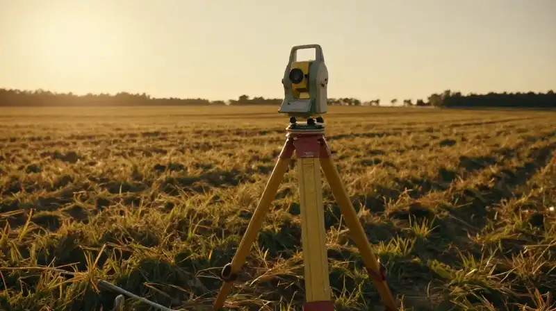
- Total Stations: Highly sophisticated electronic instruments used to measure both angles and distances with extreme accuracy. They are used to establish precise points in space.
- Global Positioning System (GPS) / GNSS: Modern GPS equipment significantly increases the speed and accuracy of field operations, allowing surveyors to quickly map large areas and correlate physical points to a recognized geodetic grid system.
- Geographic Information Systems (GIS): Surveyors use GIS software to manage, analyze, and present the vast amounts of collected spatial data, making it easier for civil engineers to incorporate site information into large-scale designs.
This combination of tools ensures that the measurement of a property is as precise as possible, minimizing the risk of miscalculation during development.
Specialized Types of Surveys
Not all surveying tasks are the same. Land surveyors specialize in different types of projects depending on the legal or engineering need. Understanding the specific survey type is vital to determining if your particular problem can be solved by a professional. The major specialties include:
- Boundary Surveys: The most common type, used to determine and confirm the exact location of property lines.
- Topographic Surveys: Used to map the natural and man-made features of a property, showing elevation and contours.
- Construction Surveys: Conducted on an active job site to lay out building corners, roads, and infrastructure based on engineering plans.
- ALTA Surveys: A specific, highly detailed survey used for commercial properties, providing maximum detail required by mortgage lenders and financial institutions.
- Subdivision Surveys: Used when a large parcel of land is being split into smaller lots, requiring the establishment of new street grids and legal parcels.
Career Path and Economic Outlook
Choosing a career as a land surveyor requires significant education, skill, and dedication. It is a highly regulated profession due to its legal implications. Requirements to Become a Surveyor: Most states mandate that anyone performing this work must be a professional, licensed surveyor. Typically, the path involves:
- Earning a Bachelor’s degree in Land Surveying or a closely related discipline (such as Civil Engineering or Geomatics).
- Gaining practical field experience.
- Passing multiple rigorous professional examinations required by the state licensing board.
Salary and Growth: The profession generally offers strong earning potential. As of recent reports (May 2024), the median annual wage for land surveyors is around $72,740. The outlook for the profession remains positive, with employment projections showing expected growth between 2024 and 2034, driven by continued construction and infrastructure needs.
Distinguishing Surveyors vs. Engineers: Clarifying the Role
A common point of confusion is the difference between a surveyor and a civil engineer. While they often work together, their primary functions are different. | Role | Primary Function | Focus | | :--- | :--- | :--- | | Land Surveyor | Measures and documents the physical location of features on the Earth’s surface. | *Where* is the line? *Where* is the elevation? | | Civil Engineer | Designs structures, manages systems, and determines how those features will function. | *How* should this road slope? *What* size should the foundation be? | The surveyor provides the accurate, legally defined “map” and “coordinates,” while the engineer takes that map and applies technical design and physics to create the functional plan.
Practical Considerations for Choosing a Surveyor
When dealing with property boundaries or major construction, the quality of the surveyor you hire is critical to avoid future legal disputes and expensive errors. **Why Licensing Matters:** It is important to remember that a licensed land surveyor is legally authorized to certify the accuracy of the documentation. Hiring an unlicensed or “handyman” mapper can result in documentation that holds no legal standing and is inadmissible in court. **What to Confirm Before Hiring:** Before signing any contract, ensure the professional can clearly answer these points:
- Do they specialize in the type of survey you need (e.g., ALTA vs. boundary)?
- Do they provide a detailed scope of work and a clear explanation of what “found data” (previous records) they will be reviewing?
- Are they licensed in your specific state and jurisdiction?
- What technology will they use, and what is the estimated timeline for delivery?
Final synthesis: Land surveyors are essential guardians of our built environment and our property rights. Their work is a blend of rigorous mathematics, advanced technology, and meticulous legal record-keeping. By engaging a licensed professional, you ensure that your property boundaries are defined with legal certainty and that your construction plans are rooted in the precise reality of the land.
How to Choose a Land Surveyor
Check Specialization
Confirm whether the surveyor specializes in the specific type of survey you need, such as ALTA vs. boundary surveys.
Review Scope and Data
Request a detailed scope of work and a clear explanation of what "found data" (previous records) they plan to review.
Verify Licensing
Ensure the professional is licensed in your specific state and jurisdiction.
Determine Logistics
Ask what technology they will use and what the estimated timeline for the survey's delivery is.
Related Articles